A number of wildfires are burning across California, predominantly to the north and west of Los Angeles, with Governor Gavin Newsom declaring a state of emergency on Tuesday.
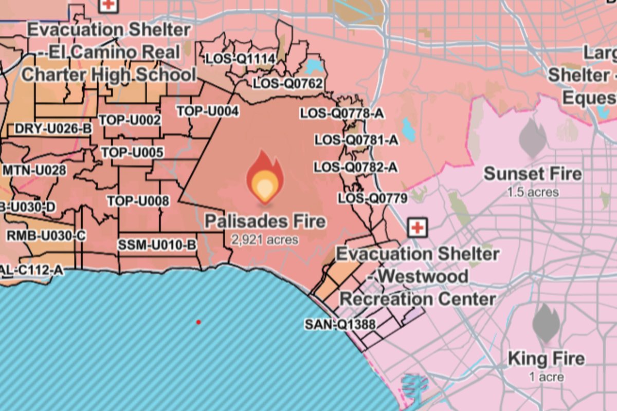
The largest of the infernos, which hit the upmarket Pacific Palisades neighborhood, has burned through more than 2,900 acres with meteorologist Paul Deanno describing it as a "near worst-case scenario," noting the winds.
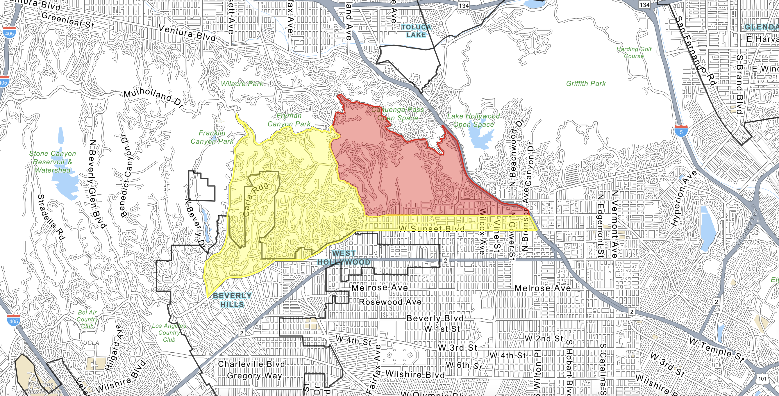
Three additional wildfires are ablaze to the north of Los Angeles according to monitoring website Watch Duty, with the second largest being the Eaton Fire which has ripped across 1,000 acres, according to the California Department of Forestry and Fire Protection (CAL FIRE). An additional blaze broke out much further south near San Diego, which consumed two acres.

President Biden announced on Tuesday evening that the Federal Emergency Management Agency (FEMA) had "approved a Fire Management Assistance Grant to support areas that are impacted."
Palisades Fire
By some margin the largest of the California infernos, the Palisades fire had consumed 2,921 acres in the Pacific Palisades as of 3 a.m. ET on Wednesday, according to the CAL FIRE.
The agency said to expect "extreme fire" with "wind gusts up to 60 MPH [miles per hour]" expected through Thursday as it responds along with Los Angeles County Fire and Los Angeles City Fire.
According to the California Department of Transportation, the Pacific Coastal Highway has been closed between Las Flores Canyon Road and the Santa Monica Freeway.

CAL FIRE Evacuation Orders, meaning there is a lawful order to leave in response to an "immediate threat to life," are in place for LOS-Q0767, MAL-C111-A, MAL-C111-B, MAL-C112-B, RMB-U030-A, RMB-U030-B, SAN-Q1395-B, SAN-Q1396-B, SSM-U010-A, SSM-U010-B, TOP-U001, TOP-U002, TOP-U003, TOP-U004, TOP-U005, TOP-U006, TOP-U007, TOP-U008, TOP-U009.
Evacuation Warnings, with "potential threat to life and/or property, have also been declared for CAL-C405, CAL-C406, CAL-C407, CAL-C408, CAL-C409, CAL-C410, CAL-C411, CAL-C412, CAL-C413, CAL-C414, CAL-C415, DRY-U026, MAL-C112, MAL-C112-A, MTN-U028, RMB-U030-C, RRC-U027, SAN-Q1395-A, SAN-Q1396-A, SDP-U029.
The Westwood Recreation Center at 1350 South Sepulveda Blvd and the El Camino Real Charter High School at 5440 Valey Circle Blvd have both been turned into evacuation centers. CAL FIRE said the cause of the Palisades fire is currently under investigation.
Eaton Fire
The Eaton Fire, situated on the northern outskirts of Pasadena, has consumed 1,000 acres as of early Wednesday morning, according to CAL FIRE.
The agency said: "High winds are driving rapid fire growth, posing a significant threat to nearby communities and making containment efforts challenging.
"Firefighters are working aggressively to slow the spread and protect critical infrastructure under extreme conditions. The combination of low humidity, dry fuels, and shifting winds has heightened the potential for spot fires and rapid expansion. Residents are urged to remain alert and follow instructions from local authorities as the situation evolves."

All schools in the Pasadena Unified School District have been closed on January 8.
Evacuation orders have been issued for "Zones ALD-EASTLOMA, ALD-EATONCANYON, ALD-GARFIAS, ALD-MENDOCINO, ALD-MIDLOTHIAN, ALD-MOUNTLOWE, ALD-RUBIO, ARC-001, ARC-002, ARC-004, KIN-KINNELOA, LAC-E183, PAS-E019, PAS-E022, SMD-E001, SMD-E002, SMD-E003, SMD-E004, SMD-E005, SMD-E006, SMD-E007, SMD-E008, SMD-E009, SMD-E010, SMD-E011, SMD-E012, SMD-E013, SMD-E014, SMD-E015, SMD-E016, SMD-E017, SMD-E019." They also cover the "area north of Orange Grove/Rosemead Blvd., east of Lake Ave., and west of Michillinda Ave."
The El Camino Real Charter High School on 5440 Valley Circle Blvd, the Pasadena Convention Center at 300 E Green St and the Westwood Recreation Center on 1350 S Sepulveda Blvd have been turned into evacuation shelters.
Hurst Fire
The Hurst Fire has engulfed 100 acres near Diamond Road, Sylmar, according to CAL FIRE with evacuation orders in place for "LAC-E132-A, LAC-E132-B, LOS-E001, SCL-CALGROVE, SCL-ETERNAL, SCL-NEWHALLPASS, SCL-WILDWOOD," though the agency warns these are "rapidly changing."
According to CAL FIRE: "The Hurst Fire is spreading rapidly under high winds, creating dangerous conditions for nearby communities. Fire crews are working tirelessly to contain the fire and protect critical infrastructure as it threatens homes and other structures.

"The combination of dry fuels, strong winds, and low humidity is contributing to aggressive fire behavior, making containment efforts extremely challenging. Residents are urged to remain vigilant and follow directives from local authorities as the situation evolves."
Tamarack Fire
According to Watch Duty, a 0.5-acre blaze is underway near where Tuxford Street bisects the Golden State freeway in northern Los Angeles.

Watch Duty staff reporter Michael Silvester described it as a "vegetation fire" covering "a half acre of grass and pine trees adjacent to the freeway."
Freeway Fire
Watch Duty reported a two-acre blaze underway in southern California on the northern outskirts of San Diego by the Cabrillo Freeway, close to Marine Corps Air Station Miramar.


 English (US) ·