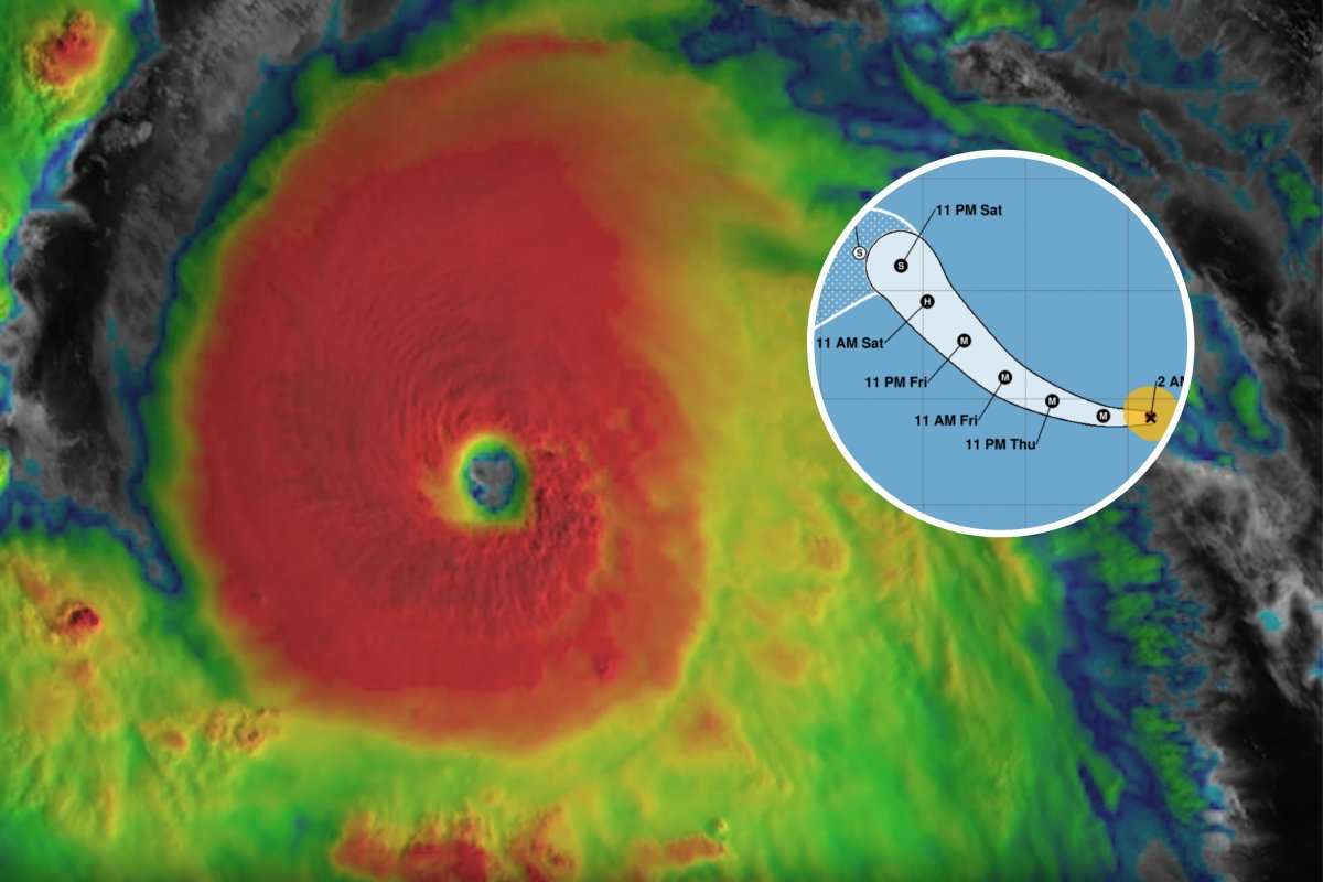
As Hurricane Kristy intensified into a major hurricane, NOAA satellites snapped some spectacular videos of the storm from space.
Kristy, formed from the remnants of Atlantic Tropical Storm Nadine earlier this week, is barreling westward across the Eastern Pacific at powerful wind speeds of 150 miles per hour.
The storm is now a Category 4 hurricane, hitting Category 1 strength on Tuesday and Category 3 on Wednesday. Major hurricanes are classified as any storm at Category 3 or greater.
"Kristy is forecast to remain within a favorable environment for the next 24 hours or so, with warm sea surface temperatures and light vertical wind shear. The intensity forecast calls for some slight re-intensification during this time," the NHC said in a forecast discussion at 8 a.m. PDT on Thursday.

Kristy is not expected to impact the United States, but it may trigger "life-threatening" waves off the coast of Baja California in Mexico.
"Swells generated by Kristy will affect portions of the west coast of the Baja California peninsula late this week and over the weekend. These swells are likely to cause life-threatening surf and rip current conditions," the NHC warned.
Kristy is a Pacific hurricane, meaning it follows different rules to those seen in the Atlantic, like Hurricane Milton and the others that have impacted the U.S. this year.
Atlantic hurricanes often move toward the U.S. mainland or the Caribbean islands, while Pacific hurricanes tend to move away from the Mexican coast and head out to the open ocean, although they occasionally affect Mexico or Hawaii.
The Atlantic hurricane season runs from June 1 to November 30, while the Pacific hurricane season runs from May 15 to November 30 in the Eastern Pacific and from June 1 to November 30 in the Central Pacific.
The Eastern Pacific has consistently warmer waters than the Atlantic, which usually results in storms forming earlier and more frequently. The first Eastern Pacific hurricane this year was Hurricane Carlotta in early August.
"Tropical cyclones can only form if conditions in the atmosphere are right, even if ocean temperatures are high enough," Liz Stephens, a professor of meteorology at the University of Reading, told Newsweek.
Kristy is expected to continue moving northwestwards across the Pacific as a major hurricane before weakening back down to a tropical storm and veering to the southwest.
"The environment quickly becomes hostile with strong wind shear, drier air and cooler sea surface temperatures along the forecast track of Kristy," the NHC said. "The NHC intensity forecast follows these trends, showing rapid weakening, and now has the remnant low status at 72 h, and dissipation at 120 h."
Do you have a tip on a science story that Newsweek should be covering? Do you have a question about hurricanes? Let us know via science@newsweek.com.


![SOURCE SPORTS: [WATCH] Mets Capt. David Wright Gives Interesting Insight On The Honor Of His Jersey Retirement In Citi Field](https://thesource.com/wp-content/uploads/2025/01/01fs75fy836w8mp4ytwr.webp)


 English (US) ·