Millions of Americans are bracing for severe weather, with 15 states under winter weather warnings and up to 20 inches of snow expected.
It comes amid Winter Storm Blair, which the National Weather Service (NWS) has warned will produce "Arctic outbreaks" in many areas of the country.
Why It Matters
Heavy snow could cause widespread disruption, making travel challenging and potentially dangerous, with reduced visibility, slick roads and the risk of accidents or delays.
Storm Blair has already caused four deaths after crashes that occurred due to dangerous conditions on the roads. Additionally, more than 2,300 flights within, into or out of the U.S. were canceled on Monday, according to FlightAware.com, and many schools remain closed.
What to Know
At the time of writing, storm warnings were active in Alaska, Colorado, West Virginia and Maryland, while winter weather advisories were issued for Nevada, Montana, Wyoming, New Mexico, Texas, Oklahoma, North Carolina, Tennessee, Virginia, New York and Vermont.
A winter weather advisory indicates conditions pose a significant inconvenience, and if caution is not exercised, there could be situations that may threaten life and/or property, according to the NWS. A storm warning indicates that heavy snow of at least 6 inches in 12 hours, or at least 8 inches in 24 hours, is expected.
In Colorado, heavy snow is predicted to persist through Tuesday, with accumulations between 4 and 10 inches in localized areas. Similarly, in Alaska's Thompson Pass, snowfall could reach up to 20 inches, accompanied by gusts of up to 50 mph. Maryland and West Virginia are also experiencing severe winter weather, with road conditions becoming increasingly dangerous overnight.
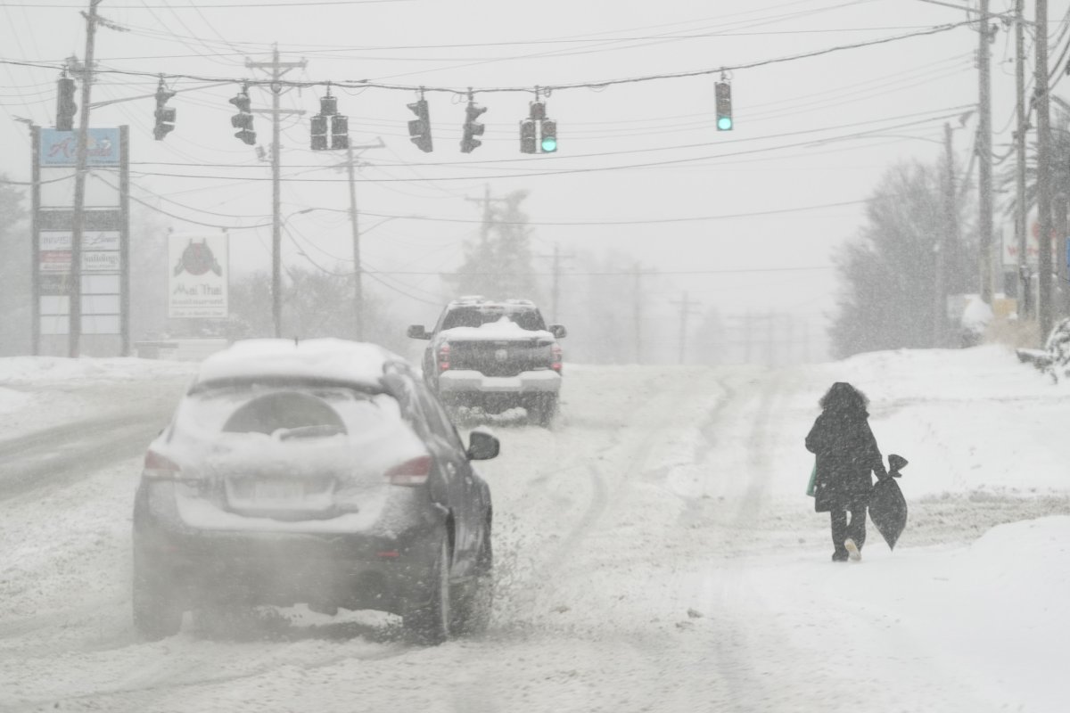
Meanwhile, the Sangre de Cristo and Wet Mountains in Colorado are expected to see 3 to 8 inches of snow. Similar accumulations are predicted in parts of New York, including Southeastern St. Lawrence, Western Clinton and Franklin Counties, as well as in Vermont's Franklin, Lamoille and eastern Chittenden Counties. The heaviest snow is expected between 4 a.m. and 4 p.m. on Tuesday, with rates reaching up to half an inch per hour.
Winds will be strongest in Alaska, where gusts of up to 65 mph are forecast between Denali Park and Healy until noon on Tuesday. In North Carolina, Madison, Mitchell and Yancey Counties will experience winds of 55 mph until 6 a.m. on Tuesday.
Severe weather conditions may also cause power outages and downed trees. Significant ice accumulation is expected on power lines and tree limbs in portions of central, southwest and west-central Virginia, as well as southeast West Virginia. This may result in widespread and long-lasting power outages. The combination of very cold temperatures and power outages could create severe heating challenges.
"Do not touch downed lines and report any power outages to your electric company. Travel is highly discouraged due to slick roadways and the possibility of downed trees and power lines," the NWS warned.
In portions of central, southwest and west-central Virginia, southeast West Virginia and northwestern North Carolina, black ice will pose a major hazard on roads, particularly in areas where melting snow and ice refreeze overnight.
Amid the challenging conditions, residents are encouraged to delay unnecessary travel, with the NWS urging extreme caution for those needing to travel, advising motorists to keep emergency supplies such as flashlights, food and water in their vehicles. Drivers should also avoid sudden braking or acceleration, and exercise particular care on hills and during turns. Ensuring that vehicles are properly winterized and in good working order is also strongly recommended.
Travel conditions are expected to remain challenging due to slick roads, reduced visibility and blowing snow.
What People Are Saying
Appalachian Power, which serves parts of West Virginia and Virginia, said in a post on X (formerly Twitter): "Winter Storm Blair has left behind treacherous road conditions, downed power lines and fallen trees in most of our service territory."
AccuWeather lead long-range expert Paul Pastelok said: "This could end up being the coldest January since 2011 for the U.S. as a whole."
He also noted that the storm's Arctic outbreak will "involve many days and not just be a quick one-to-three-day event."
What Happens Next
The warnings come amid reports that a polar vortex could bring the coldest January the U.S. has faced in years.
A polar vortex is a stream of cold air that normally spins around the north pole, but occasionally it extends down into the United States, Europe or Asia.
"Below-normal temperatures are favored across the central and eastern U.S. during much of January," the NWS said last week.







 English (US) ·