Google Maps has evolved beyond navigation and traffic reporting to become a crucial tool for community safety. While specialized apps like Watch Duty focus specifically on fire tracking, Google Maps' Crisis Alerts feature provides comprehensive emergency information accessible to anyone with a smartphone.
By combining data from SOS Alerts influenced by government agencies, first responders, trusted media outlets, and NGOs along with real-time satellite imagery from the National Interagency Fire Centre, it offers reliable, up-to-date information about active wildfires.
Whether you're reporting road closures, sharing updates about conditions, or marking dangerous areas, your input helps create a more complete picture of the situation. Let's explore how you can use Google Maps to both stay informed and help keep your community safe during wildfire seasons.
1. Locate the wildfire
(Image: © Future)
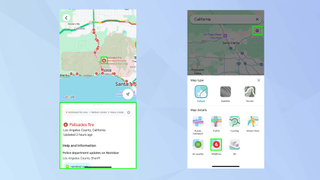
Use Google Maps to search for the vicinity of the wildfire and zoom in. If it’s a fresh fire then you may not find any current reports — but if it is known about, you can tap the Crisis icon to see information and guidance in the sheet beneath the map. You can also tap the Layers icon and select the Wildfires button.
2. Send some feedback
(Image: © Future)
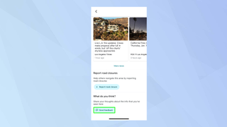
You can’t actually report a wildfire itself using Google Maps. For that, you should directly contact the emergency services by dialling 911. But you can share your thoughts on the information which exists. Scroll to the bottom of the sheet and tap Send Feedback.
3. Report a road closure
(Image: © Future)
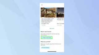
If you come across road closures or roads that have been impacted by a wildfire, again scroll to the bottom of the sheet and select Report Road Closure.
4. Enter some details
(Image: © Future)
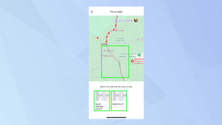
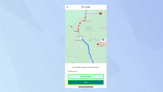
First, tap a road that you want to share information about then, if necessary, clarify which road you mean if Google Maps displays some options.
5. Choose a road section
(Image: © Future)
Now select the portion of the road that is affected and tap Next or tap Edit Entire Road if it’s a wider issue.
6. Share impact information
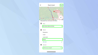
(Image: © Future)
You can now begin to fill in details such as when the road was closed, the reason for it – Nature – and the direction the road is closed. Scroll a little more and you will see an option to enter further details. When you’re finished, tap Send.
There are other ways of gathering or reporting information during a crisis. You could, for example, learn how to check air quality on Google Maps and how to alert drivers to road hazards. And if you're a Google Pixel user, you can set up Crisis Alerts on your smartphone.











 English (US) ·