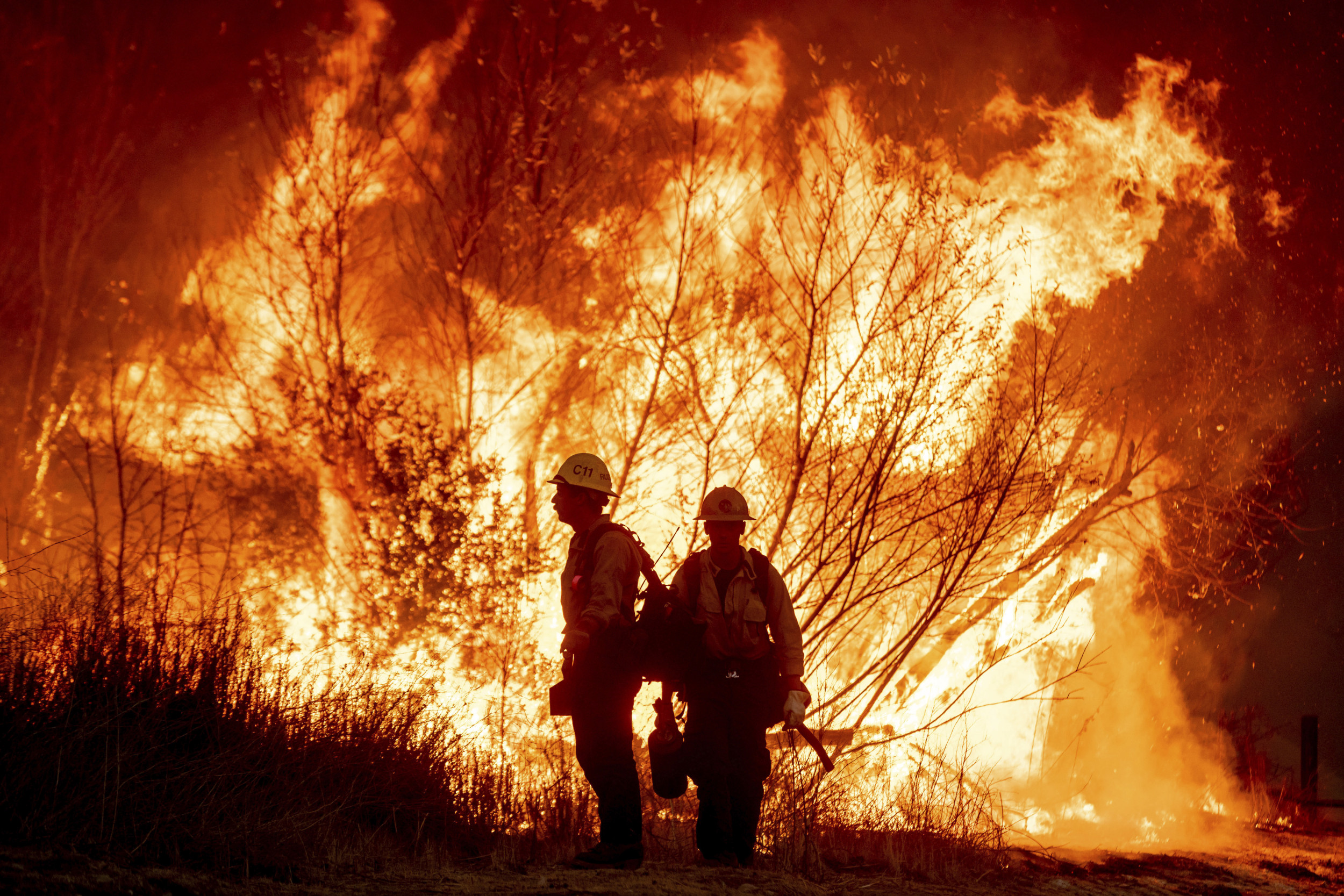
Devastating wildfires have continued to devastate Los Angeles this week, after first breaking out last Tuesday.
At least 24 people have died in the Eaton and Palisades fires, according to the latest update from the County of Los Angeles Medical Examiner, while others remain missing.
LA's National Weather Service (NWS) has warned about winds causing a "particularly dangerous situation," with gusts between 45 and 70 miles per hour.
While these are "weaker than those last week," the winds, expected to occur between 4:00 a.m. on Tuesday and 12:00 p.m. on Wednesday, "will be strong enough to potentially cause explosive fire growth.
"In other words, this setup is about as bad as it gets," the NWS said in an update posted to X on Monday night.
Newsweek has rounded up the latest information on the newest fire which started on Monday night, the Auto, as well as the Palisades and Eaton fires.
Auto Fire
The Auto fire is around the Santa Clara River near Ventura Rd & Auto Center Dr, in Ventura and was mapped at 55.7 acres by FIRIS OES INTEL 24 in the late hours of Monday night.
Ventura County Fire Department's (VCFD's) Public Information Officer said in a recent update that the blaze's forward progress has been stopped but there is 0 percent containment, meaning secure fire lines around the perimeter have not yet been established.
"The fire was confined to the river bottom and no structures were threatened," the VCFD said, "the cause of the fire Is under investigation."
There is an evacuation order in place that was issued by the Ventura County Sheriff earlier on Monday evening, covering the river bottom. Nearby Victoria Avenue was under an order or advisory but the threat has been mitigated and this road is now open in both directions.

Palisades Fire
The Palisades fire, southeast of Palisades Drive and Calle Victoria, in Pacific Palisades, has been raging since January 7 and covers 23,713 acres. It was 14 percent contained as of just after 9:00 p.m. on Monday.
The following zones are under mandatory evacuation orders:
DRY-U026-A, LOS-Q0406-A, LOS-Q0407, LOS-Q0751, LOS-Q0762, LOS-Q0762-A, LOS-Q0765, LOS-Q0767, LOS-Q0778-A, LOS-Q0780, LOS-Q0781-A, LOS-Q0782-A, LOS-Q0782-B, LOS-Q0798, LOS-0798-B, LOS-Q1115, LOS-Q1118, MAL-C111-A, MAL-C111-B, MAL-C112-B, MTN-U028, RMB-U030-B, RMB-U030-D, RMB-U030-E, RRC-U027, SAN-Q1395-B, SAN-Q1396-B, SDP-U029, SSM-U010-A, SSM-U010-B, TOP-U001, TOP-U002, TOP-U003, TOP-U004, TOP-U005, TOP-U006, TOP-U007, TOP-U008, TOP-U009.
The following zones are under evacuation warnings:
CAL-C405, CAL-C406, CAL-C407, CAL-C408, CAL-C409, CAL-C410, CAL-C411, CAL-C412, CAL-C413, CAL-C414, CAL-C415, DRY-U026-B, LOS-Q0764, LOS-Q0772, LOS-Q0779, LOS-Q0783, LOS-Q0800, LOS-Q1089, LOS-Q1119, LOS-Q1163, MAL-C112-A, MCR-U021-A, RMB-U030-C, SAN-Q1388-B, SAN-Q1395-A.

Eaton Fire
The Eaton fire, which also started on January 7, is located northeast of Altadena Drive and Midwick Drive, in Eaton Canyon, Altadena/Pasadena. It also spans 14,117 acres, according to CALFIRE, and was 33 percent contained as of 8:30 p.m. on Monday.
The following zones are under mandatory evacuation orders:
ALD-ARROYOSECO, ALD-CALAVERAS, ALD-CANON, ALD-CASITAS, ALD-CHANEY, ALD-EASTLOMA, ALD-EATONCANYON, ALD-FARNSWORTH, ALD-GARDEN, ALD-LAUREL, ALD-MEADOWS, ALD-MENDOCINO, ALD-MIDLOTHIAN, ALD-MILLARD, ALD-MOUNTLOWE, ALD-PALM, ALD-RUBIO, ALD-WAPELLO, ALD-WHITEPARK, KIN-KINNELOA-A, LAC-E165-B, LAC-E167, LAC-E168-A, LAC-E183.
The following zones are under evacuation warnings:
ALD-GARFIAS, ARC-001, LCF-CROWN, LCF-JPL, LCF-STARLIGHT, PAS-E006, PAS-E008, PAS-E010, PAS-E012, PAS-E014, PAS-E018, PAS-E019, PAS-E022-A, PAS-E022-B, SMD-E001, SMD-E002, SMD-E003, SMD-E004, SMD-E005, SMD-E006, SMD-E007, SMD-E008, SMD-E009, SMD-E010, SMD-E011, SMD-E012, SMD-E013, SMD-E014, SMD-E015, SMD-E016, SMD-E019, KIN-KINNELOA-B.


 English (US) ·