Deadly and destructive fires in the Los Angeles region, which continue to be fueled by a dry landscape and high winds, have been captured in NASA satellite imagery.
There has been some progress by firefighters against the deadly wildfires, which have been burning now for more than a week, but more than 100,000 people remain under evacuation orders, with 24 deaths reported by The Associated Press at time of writing.

As of early Tuesday, all the fires burning in the region covered about 39,000 acres, with firefighters saying that they had halted the forward march of a fire in Ventura County.
The Palisades and Eaton fires, which have been burning for a week, broke out on January 7. These are the largest of several fires that have voraciously burned in the Los Angeles region fanned by strong Santa Ana winds.
These strong, dry and warm winds begin inland in the Great Basin and then move to the coast and affect Southern California and Baja California.
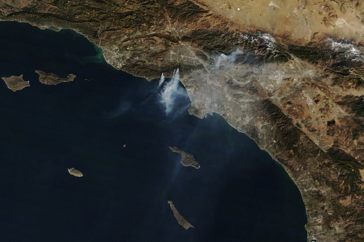
The image above, which was captured by the Moderate Resolution Imaging Spectroradiometer (MODIS) aboard NASA's Terra Satellite was taken at approximately 10 a.m. on January 10.
In the center of the image there are several distinct plumes of smoke streaming south onto the Pacific Ocean from the Palisades fire, which was burning through the Pacific Palisades neighborhood and west into Malibu.

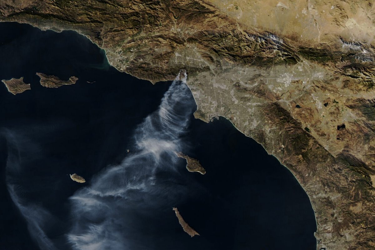
The above image was taken on January 11, by the MODIS instrument on NASA's Aqua satellite. It was captured at around 2 p.m. local time. The orbit of the Aqua satellite is timed in such a way that it captures images of Earth each afternoon, while the Terra does so in the morning.
NASA has a number of satellites, including Aqua, that observe the Earth and maintain a continuous stream of climate data records.
On the afternoon of January 11, while both the Palisades and Eaton fires remained active, only smoke plumes from the Palisades fire were clear in the image.
At time of writing, the Palisades fire had grown to over 23,700 acres and was 17 percent contained, while the Eaton fire had expanded to 14,117 acres and was 35 percent contained, according to Cal Fire.
Some relief from the strong windy conditions on January 11 had helped firefighters on the ground make progress toward containing both blazes, but strong winds returned in the days that followed.
NASA's Disaster Response Coordination System has been activated to support all of the agencies responding to the fires, including the California Governor's Office of Emergency Services.
The response team is posting maps and data products on its open-access mapping portal as new information becomes available.
NASA Earth Observatory images by Wanmei Liang, using MODIS data


 English (US) ·